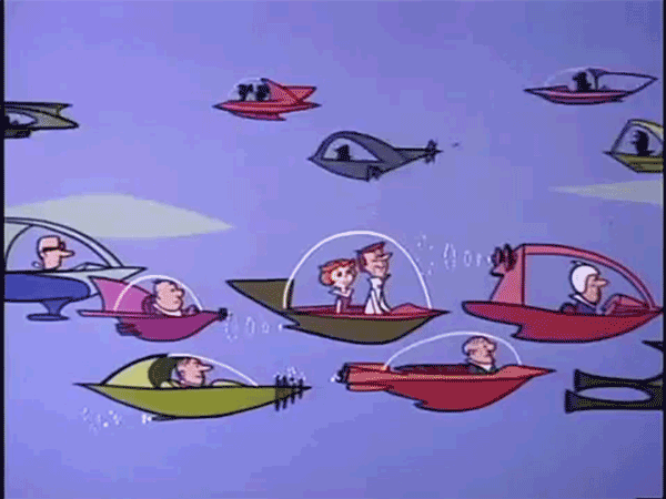

In the Jetsons, we see thousands of flying cars zooming about in an invisible lattice in the sky, safely. This got me thinking. What is needed before we can trust something like that existing in the heavens above London?
Many of us in London bemoan the decision to expand Heathrow because of noise implications (we’ll come to that in a later blog). We are told that it is too congested. In the meeting I attended with TfL on flying cars, they claimed that London had the world’s most congested airspace, which is why helicopter flights are so difficult to approve. Yet when you look up at the sky in most parts of London, you’ll almost never see an aircraft. What’s going on?
The Challenge
The first challenge for any mobility system is for its vehicles not to crash into each other . On roads this is achieved by the individual drivers using their eyes and the speed limits – but we still get collisions. In the skies, passenger aircraft are flying at anywhere between 300 and 900 kilometers per hour. The nearest collision is likely beyond your visual range, and that’s if it’s daytime. On top of that, aircraft fly in 3D, so the next collision could be above, behind and below you. Picture making a wrong turn in this environment:
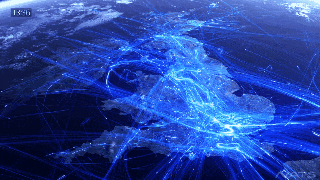
In this challenging 3D environment we need a way of tracking the position, including altitude and importantly speed and heading of all vehicles in a space to make sure their current paths are clear, but also that there is enough separation that emergency action by any aircraft won’t mess things up for others – this explains why London’s air space is clear according to our eyes, as clearances for large aircraft mean they would look like sparse specks on a map. Tracking the aircraft is done by technology – GPS, radar and VHF ranging, but – believe it or not – it’s human beings at the end who oversee the management of air space using this information. They’re called air traffic controllers (ATC).
ATC Today
The International Civil Aviation Authority (ICAO) was convened in 1944, at the end of the war, to develop a shared set of rules for all the member countries to allow safe air travel between them – this includes things like aircraft call-signs, identification protocols, and flying at even altitudes (for example 34,000 ft) when flying West, and odd ones when (e.g. 35,000) flying East.
Each country then formed its own National Aviation Authority (NAA) which made the ICAO regulations (or a variation of them) effectively into national transport law. For example, the UK’s Civil Aviation Authority effectively rolls up in the Government’s Department for Transport, and sets the rules for any flying passenger vehicle over UK skies.
Europe’s NAA’s are in theory able to join up and manage the whole of Europe, since regulations are so similar and borders are adjacent – this collection of NAAs is called Eurocontrol, and Eurocontrol is working towards a fully joint up European sky in a programme called SESAR.
That’s for international travel. If we want to get back into the Grand Challenge in the UK, i.e. flying cars and urban air vehicles, we need to focus on the CAA, its service providers and the technology available.
(Civil Use) Radar Today
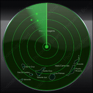
Radio Detection and Rangin, or RADAR has been around since the beginning of the century, and is still the most widely used way of tracking moving objects. An electromagnetic pulse of a specific frequency is emitted into space, and when it hits something, it bounces back to a receiver. By triangulation of the emitted and received rays, the location of the object can be determined, and by measuring the Doppler shift of the ray, the speed of the object can be worked out (at the time the ray hit it).
The range and resolution of the RADAR depends primarily on the power source of the emitter. If you wanted to see all around you, you’d send out a spherical beam, but since the power of your emitter would be spread over a huge surface area, the intensity at any given point would be low, meaning your resolution would go down, and you’d need a huge amount of power to compensate.
You could instead focus a beam in one direction, and mount it on a rotating platform, but that introduces some other limitations; depending how quickly the objects move compared to the rotational speed of the emitter, you may lose track of them. In the below gif what we’re seeing is a snapshot of each wedge in the map which is updated at the frequency of rotation.
Back when computers were rudimentary, each returned signal had to be interpreted and classified at the same rate or faster as the signal swept around a circle; this again placed limitations on how fast you could sweep, but also the number of targets that could be simultaneously tracked.
Limitations to Today’s RADAR systems
Aside from the range and power constraints already mentioned, the frequency bands of the the electromagnetic bands that the radar can use are assigned by the CAA. Jamming or interference of the RADAR system can be done by sending noise or false readings at these frequencies to the receiver, confusing the processor into seeing things that aren’t there – this is the basis of electronic warfare.
Target classification and identification is a challenge to the processor that interprets the receiver signals: emitted signals reflect not only off aircraft, but birds, wind farms and skyscrapers. Certain wave frequencies can get diffracted by high terrain or weather systems. And once the signals are back, the processor needs to piece together not only that something is there, but what exactly it is. Back in 1944 at ICAO aircraft were much fewer and slower, and this was not too much an issue.
Today however, if we want to track thousands of tiny, zippy delivery drones and flying cars around Hong Kong, we need much more sophisticated systems.
RADAR Tomorrow
The emitter and receiver problems discussed earlier are physical limitations which can be crudely addressed by having a higher power input, or more efficient electronics in the emitter and receiver electronics. The electromagnetic frequency bands available is a regulatory decision, which is becoming a bit more of an issue these days as certain frequencies are becoming saturated, and The frequency bands available today for RADAR may not be the optimal ones for detecting much smaller objects.
Where technology has been able to make a difference however is in computing power and efficiency. Faster processors can track more targets. Intelligent signal processing coupled with machine learning can intelligently classify birds from wind turbines and drones.
To manage an airspace like London, a 3D “always on RADAR” will likely be needed, compared to the rotating architecture of old which is like rotating a blinkered animal and asking them to constantly report what they see. This market is expect to grow nearly 20% annually and UK players such as have Aveillant (Now part of Thales) compelling products, as do SAAB and Rockwell Collins .
One last thing – TCAS
All of this has so far been about centralised control of the airspace – one central radar air space manager such as NATS sees all and controls all. As the number of vehicles spirals, and vehicles become much more zippy, how efficient can this be?

One thought on “Mobility 2 – Keeping Track”